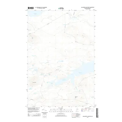
2014 Map of Millinocket Lake West
USGS Topo · Published 2014About this map
Millinocket Lake and Little Millinocket Lake dominate this northern Maine landscape, where a dense network of water bodies and timber roads defines the geography. The terrain is structured by prominent elevations including Caribou Ridge and Millinocket Ridge, which separate the various watersheds. In the northern reaches, Munsungan Lake feeds into Munsungan Stream at Munsungan Falls, eventually joining Brown Brook. The region is crisscrossed by essential logging and access routes such as Pinkham Rd and Huber Rd, reflecting the modern industrial use of these deep woods. This 2014 survey documents a complex hydrology where smaller basins like Big Caribou Pond, Elsie Pond, and Atkins Pond are interconnected by seasonal flows like Chandler Brook and Caribou Brook.
Find a feature on this map
29 named features on this map. Tap any name to fly to it.
Don’t see what you’re looking for? This feature index may not catch every label — zoom into the map to look around manually.
Map Details
Editions of this 2014 Millinocket Lake West Map
This is the sole edition of this map. No revisions or reprints were ever made.
Other maps of this area

1953 · Telos Lake
USGS Topo · 1:62,500

1954 · Spider Lake
USGS Topo · 1:62,500

1954 · Millinocket Lake
USGS Topo · 1:62,500

1954 · Presque Isle
USGS Topo · 1:250,000

1955 · Traveler Mountain
USGS Topo · 1:62,500

1957 · Telos Lake
USGS Topo · 1:62,500

1958 · Presque Isle
USGS Topo · 1:250,000

1960 · Presque Isle
USGS Topo · 1:250,000

1961 · Spider Lake
USGS Topo · 1:62,500
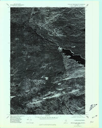
1975 · Traveler Mountain NW
USGS Topo · 1:24,000