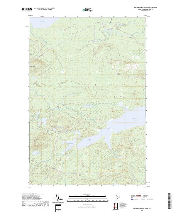
2024 Map of Millinocket Lake West
USGS Topo · Published 2024About this map
Millinocket Lake and its smaller counterpart, Little Millinocket Lake, dominate this interior Piscataquis County landscape, joined by the narrow channel known as The Thorofare. The topography is defined by significant rises such as Millinocket Ridge and Caribou Ridge, which separate a dense network of water bodies and feeder streams. Remote access is provided by a system of woodland roads, including Huber Rd and Pinkham Rd, which navigate the terrain between Munsungan Lake in the north and the expansive wetlands to the south.
Find a feature on this map
32 named features on this map. Tap any name to fly to it.
Don’t see what you’re looking for? This feature index may not catch every label — zoom into the map to look around manually.
Map Details
Editions of this 2024 Millinocket Lake West Map
This is the sole edition of this map. No revisions or reprints were ever made.
Other maps of this area

1953 · Telos Lake
USGS Topo · 1:62,500

1954 · Spider Lake
USGS Topo · 1:62,500

1954 · Millinocket Lake
USGS Topo · 1:62,500

1954 · Presque Isle
USGS Topo · 1:250,000

1955 · Traveler Mountain
USGS Topo · 1:62,500

1957 · Telos Lake
USGS Topo · 1:62,500

1958 · Presque Isle
USGS Topo · 1:250,000

1960 · Presque Isle
USGS Topo · 1:250,000

1961 · Spider Lake
USGS Topo · 1:62,500
1975 · Traveler Mountain NW
USGS Topo · 1:24,000