
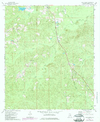
1974 Map of Millry South
USGS Topo · Published 1977About this map
The Old Indian Treaty Boundary cuts across the northern landscape of Washington County, marking a historic line through the timbered terrain south of Millry. In the mid-1970s, the St Louis-San Francisco railroad served as the primary industrial spine for this region, connecting the rural communities of Loper, Yarbo, and Jordan. This transportation network supported local resource extraction, evidenced by the Sandpit located near the headwaters of Pine Barren Creek.
Find a feature on this map
24 named features on this map. Tap any name to fly to it.
Don’t see what you’re looking for? This feature index may not catch every label — zoom into the map to look around manually.
Map Details
Editions of this 1974 Millry South Map
2 editions found
Other maps of this area

1943 · McIntosh
USGS Topo · 1:62,500

1944 · McIntosh
USGS Topo · 1:62,500

1953 · Hattiesburg
USGS Topo · 1:250,000

1958 · Hattiesburg
USGS Topo · 1:250,000

1971 · Bigbee
USGS Topo · 1:24,000

1971 · Bladon Springs
USGS Topo · 1:24,000

1974 · Chatom
USGS Topo · 1:24,000

1974 · State Line
USGS Topo · 1:24,000

1974 · Millry North
USGS Topo · 1:24,000

1974 · Copeland
USGS Topo · 1:24,000