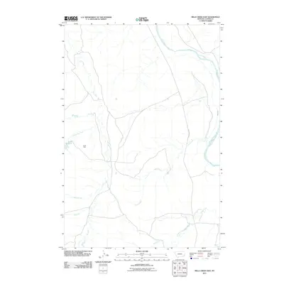
2011 Map of Mills Creek East
USGS Topo · Published 2011About this map
The Powder River meanders across this eastern Montana landscape, defining the hydrology of Custer County as it flow past a network of seasonal drainages. This high-plains environment is shaped by significant water management features, notably the Jones Reservoir and its associated Jones Dam, which provide a critical water source in a region dominated by ephemeral coulees and creeks. The drainage patterns are clearly visible through the paths of Ash Creek, May Creek, and Dead Horse Creek as they move toward the main river valley.
Find a feature on this map
11 named features on this map. Tap any name to fly to it.
Don’t see what you’re looking for? This feature index may not catch every label — zoom into the map to look around manually.
Map Details
Editions of this 2011 Mills Creek East Map
This is the sole edition of this map. No revisions or reprints were ever made.
Other maps of this area

1953 · Miles City
USGS Topo · 1:250,000

1954 · Ekalaka
USGS Topo · 1:250,000

1956 · Ekalaka
USGS Topo · 1:250,000

1957 · Miles City
USGS Topo · 1:250,000

1958 · Miles City
USGS Topo · 1:250,000

1958 · Ekalaka
USGS Topo · 1:250,000

1965 · Ekalaka
USGS Topo · 1:250,000

1969 · Tepee Butte
USGS Topo · 1:24,000
1969 · Bear Jaw Creek
USGS Topo · 1:24,000

1979 · Blacktail Creek NW
USGS Topo · 1:24,000