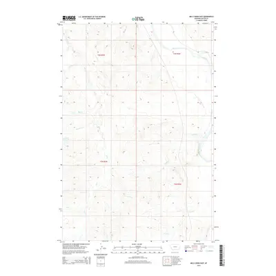
2014 Map of Mills Creek East
USGS Topo · Published 2014About this map
The Powder River carves through the northeastern corner of this Custer County landscape, defining a terrain shaped by the intricate drainage systems of Mills Cr and its tributaries. This 2014 survey captures a section of Big Sky country characterized by the winding paths of Ash Cr, Smith Cr, and Nichols Cr, which branch out across the township boundaries of T2N and T3N. Significant for local hydrology, the Jones Reservoir sits to the west, while several family-named or descriptively named waterways like Dead Horse Cr and May Cr illustrate the practical nomenclature used by those working the land. The map provides a clear view of the public land survey system divisions and the sparse network of rural roads that connect these remote drainage basins and grazing lands.
Find a feature on this map
14 named features on this map. Tap any name to fly to it.
Don’t see what you’re looking for? This feature index may not catch every label — zoom into the map to look around manually.
Map Details
Editions of this 2014 Mills Creek East Map
This is the sole edition of this map. No revisions or reprints were ever made.
Other maps of this area

1953 · Miles City
USGS Topo · 1:250,000

1954 · Ekalaka
USGS Topo · 1:250,000

1956 · Ekalaka
USGS Topo · 1:250,000

1957 · Miles City
USGS Topo · 1:250,000

1958 · Miles City
USGS Topo · 1:250,000

1958 · Ekalaka
USGS Topo · 1:250,000

1965 · Ekalaka
USGS Topo · 1:250,000

1969 · Tepee Butte
USGS Topo · 1:24,000
1969 · Bear Jaw Creek
USGS Topo · 1:24,000

1979 · Blacktail Creek NW
USGS Topo · 1:24,000