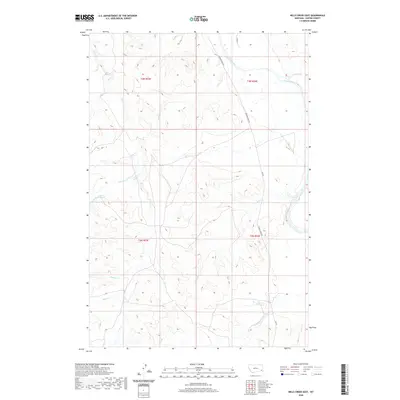
2020 Map of Mills Creek East
USGS Topo · Published 2020About this map
The Powder River meanders across the northern reaches of this Custer County landscape, defining the hydrology of a region marked by extensive drainage networks. Fed by numerous seasonal tributaries, the river corridor is flanked by the long stretch of Powder River Rd, which serves as the primary artery through the townships of t3n r54e and t2n r54e. The terrain is deeply incised by creeks with evocative local names such as Dead Horse Cr, Smith Cr, and Mills Cr, suggesting the historical importance of water access for ranching and transport in this part of Montana.
Find a feature on this map
17 named features on this map. Tap any name to fly to it.
Don’t see what you’re looking for? This feature index may not catch every label — zoom into the map to look around manually.
Map Details
Editions of this 2020 Mills Creek East Map
This is the sole edition of this map. No revisions or reprints were ever made.
Other maps of this area

1953 · Miles City
USGS Topo · 1:250,000

1954 · Ekalaka
USGS Topo · 1:250,000

1956 · Ekalaka
USGS Topo · 1:250,000

1957 · Miles City
USGS Topo · 1:250,000

1958 · Miles City
USGS Topo · 1:250,000

1958 · Ekalaka
USGS Topo · 1:250,000

1965 · Ekalaka
USGS Topo · 1:250,000

1969 · Tepee Butte
USGS Topo · 1:24,000
1969 · Bear Jaw Creek
USGS Topo · 1:24,000

1979 · Blacktail Creek NW
USGS Topo · 1:24,000