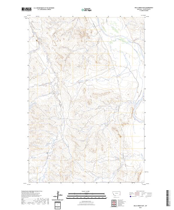
2024 Map of Mills Creek East
USGS Topo · Published 2024About this map
The Powder River cuts through the northeast corner of this Custer County landscape, defining a terrain shaped by an intricate network of seasonal drainages and named coulees. Water management in this semi-arid region is anchored by the Jones Reservoir, located west of the central hills where Moy Creek and Dead Horse Creek converge. The map documents the rural infrastructure of the early 21st century, showing how Powder River Rd and Co Rd 421 navigate the breaks and ridges between the river valley and the headwaters of Mills Creek. This detailed record of the public land survey system, including townships t3n r54e and t2n r53e, provides a precise look at the land partitions and natural landmarks used by local ranchers and land managers today.
Find a feature on this map
17 named features on this map. Tap any name to fly to it.
Don’t see what you’re looking for? This feature index may not catch every label — zoom into the map to look around manually.
Map Details
Editions of this 2024 Mills Creek East Map
This is the sole edition of this map. No revisions or reprints were ever made.
Other maps of this area

1953 · Miles City
USGS Topo · 1:250,000

1954 · Ekalaka
USGS Topo · 1:250,000

1956 · Ekalaka
USGS Topo · 1:250,000

1957 · Miles City
USGS Topo · 1:250,000

1958 · Miles City
USGS Topo · 1:250,000

1958 · Ekalaka
USGS Topo · 1:250,000

1965 · Ekalaka
USGS Topo · 1:250,000

1969 · Tepee Butte
USGS Topo · 1:24,000
1969 · Bear Jaw Creek
USGS Topo · 1:24,000

1979 · Blacktail Creek NW
USGS Topo · 1:24,000