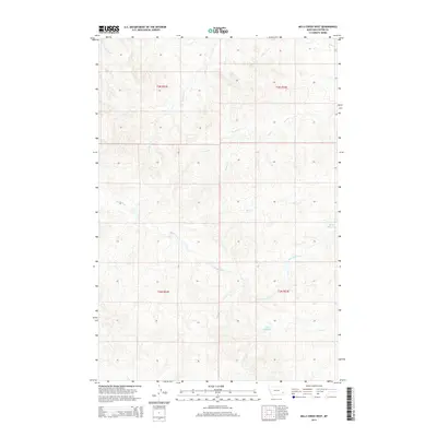
2014 Map of Mills Creek West
USGS Topo · Published 2014About this map
Monarch Cr and Elmhurst Cr carve through the high plains of Custer County in this early 21st-century topographic study. The landscape is defined by a dendritic drainage pattern typical of eastern Montana, where numerous seasonal waterways such as Forty Cr, Hercules Cr, and Dead Horse Cr feed into the regional watershed. Local water management is evident through the placement of the Jones Reservoir and Love Reservoir, which provide essential catchments in this arid rangeland. The map illustrates the sprawling Public Land Survey System (PLSS) grid, documenting the transition from t3n r52e to t2n r53e. While the area is largely devoid of dense settlements, the intricate network of creek beds like Mills Cr and Ash Cr highlights the topographic complexity of these breaks and coulees.
Find a feature on this map
17 named features on this map. Tap any name to fly to it.
Don’t see what you’re looking for? This feature index may not catch every label — zoom into the map to look around manually.
Map Details
Editions of this 2014 Mills Creek West Map
This is the sole edition of this map. No revisions or reprints were ever made.
Other maps of this area

1953 · Miles City
USGS Topo · 1:250,000

1954 · Ekalaka
USGS Topo · 1:250,000

1956 · Ekalaka
USGS Topo · 1:250,000

1957 · Miles City
USGS Topo · 1:250,000

1958 · Miles City
USGS Topo · 1:250,000

1958 · Ekalaka
USGS Topo · 1:250,000

1965 · Ekalaka
USGS Topo · 1:250,000

1969 · Forty Creek
USGS Topo · 1:24,000

1969 · Tepee Butte
USGS Topo · 1:24,000
1969 · Bear Jaw Creek
USGS Topo · 1:24,000