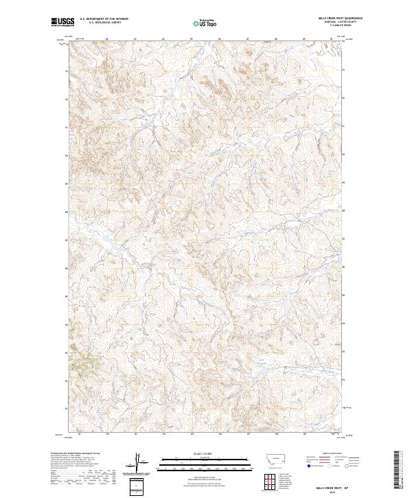
2024 Map of Mills Creek West
USGS Topo · Published 2024About this map
Mills Creek and its western tributaries define this portion of Custer County, Montana, where a complex network of seasonal drainages and small ranching reservoirs mark the high plains landscape. Water management is central to the area's geography, evidenced by features such as Love Reservoir in the southern sections and Jones Reservoir to the east. The land is characterized by a series of numbered and named coulees, including First Creek, Second Creek, and Third Creek, which flow through the dissected terrain towards larger arteries like Dead Horse Creek.
Find a feature on this map
16 named features on this map. Tap any name to fly to it.
Don’t see what you’re looking for? This feature index may not catch every label — zoom into the map to look around manually.
Map Details
Editions of this 2024 Mills Creek West Map
This is the sole edition of this map. No revisions or reprints were ever made.
Other maps of this area

1953 · Miles City
USGS Topo · 1:250,000

1954 · Ekalaka
USGS Topo · 1:250,000

1956 · Ekalaka
USGS Topo · 1:250,000

1957 · Miles City
USGS Topo · 1:250,000

1958 · Miles City
USGS Topo · 1:250,000

1958 · Ekalaka
USGS Topo · 1:250,000

1965 · Ekalaka
USGS Topo · 1:250,000

1969 · Forty Creek
USGS Topo · 1:24,000

1969 · Tepee Butte
USGS Topo · 1:24,000
1969 · Bear Jaw Creek
USGS Topo · 1:24,000