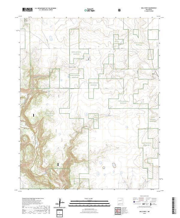
2023 Map of Mills West
USGS Topo · Published 2023About this map
The Kiowa National Grassland dominates this high plains landscape in Harding County and Mora County, characterized by dramatic canyon systems and vast open ranges. The Canadian River cuts through the southwestern portion of the sheet, carving deep relief into the terrain alongside Cañon Mestenito and the broader Mestenito Valley. These topographical features dictate the local road network, which consists primarily of unpaved routes like Mesteno Rd and Mills Canyon Rd that follow the natural contours of the land.
Find a feature on this map
21 named features on this map. Tap any name to fly to it.
Don’t see what you’re looking for? This feature index may not catch every label — zoom into the map to look around manually.
Map Details
Editions of this 2023 Mills West Map
This is the sole edition of this map. No revisions or reprints were ever made.
Other maps of this area

1954 · Santa Fe
USGS Topo · 1:250,000

1954 · Raton
USGS Topo · 1:250,000

1958 · Raton
USGS Topo · 1:250,000

1958 · Santa Fe
USGS Topo · 1:250,000

1971 · Abbott Lake
USGS Topo · 1:24,000

1971 · Beaver Canyon
USGS Topo · 1:24,000

1971 · Canon Las Cuevas
USGS Topo · 1:24,000

1972 · Canon Colorado
USGS Topo · 1:24,000
1972 · Jaritas Ranch
USGS Topo · 1:24,000

1972 · Mills West
USGS Topo · 1:24,000