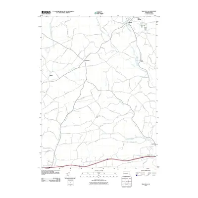
2010 Map of Millville
USGS Topo · Published 2010About this map
Little Fishing Creek and its tributary, Spruce Run, define the northern drainage of this section of Columbia County, where the borough of Millville sits as a primary center of activity. The map shows a landscape primarily defined by its watercourses and rural road networks, including the cross-roads settlement of Jerseytown and the village of Eyers Grove. The presence of the Scheck Skyline Airport and the Valley View Lake dam near East Millville provides insight into the modern infrastructure supporting this rural corridor.
Find a feature on this map
93 named features on this map. Tap any name to fly to it.
Don’t see what you’re looking for? This feature index may not catch every label — zoom into the map to look around manually.
Map Details
Editions of this 2010 Millville Map
This is the sole edition of this map. No revisions or reprints were ever made.
Other maps of this area

1889 · Catawissa
USGS Topo · 1:62,500

1892 · Catawissa
USGS Topo · 1:62,500

1892 · Shamokin
USGS Topo · 1:62,500

1893 · Shamokin
USGS Topo · 1:62,500

1894 · Catawissa
USGS Topo · 1:62,500

1894 · Bloomsburg
USGS Topo · 1:62,500

1935 · Hughesville
USGS Topo · 1:62,500

1943 · Shamokin
USGS Topo · 1:62,500

1947 · Bloomsburg
USGS Topo · 1:24,000
1947 · Catawissa
USGS Topo · 1:24,000