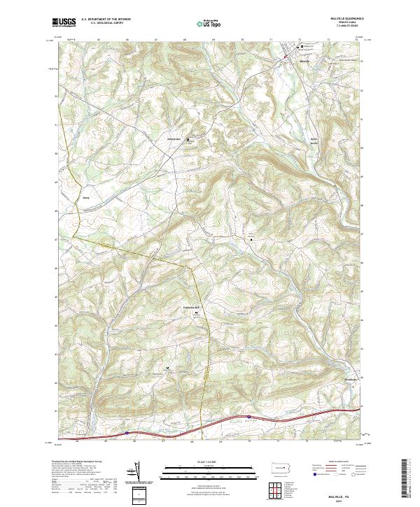
2023 Map of Millville
USGS Topo · Published 2023About this map
Millville serves as a primary hub for this portion of the Pennsylvania countryside, situated where Little Fishing Creek meets Spruce Run. The landscape is defined by its numerous small-scale settlements and agricultural valleys, including Jerseytown, Eyers Grove, and Columbia Hill. Genealogists will find significant value in the distribution of family and community burial grounds, such as the Millville Friends Cem, Longs Cem, and Dutch Hill Cem. The terrain is shaped by distinct ridges like Strawberry Ridge and Hogs Back, with the southern portion of the quadrangle marked by the prominent corridor of Frosty Valley. Waterways such as Mahoning Creek and Hemlock Creek carve through the hills, while the Lake Airport near Valley View Lake provides a modern aviation landmark amidst the traditional rural road network of the Columbia and Montour County border.
Find a feature on this map
110 named features on this map. Tap any name to fly to it.
Don’t see what you’re looking for? This feature index may not catch every label — zoom into the map to look around manually.
Map Details
Editions of this 2023 Millville Map
This is the sole edition of this map. No revisions or reprints were ever made.
Other maps of this area

1889 · Catawissa
USGS Topo · 1:62,500

1892 · Catawissa
USGS Topo · 1:62,500

1892 · Shamokin
USGS Topo · 1:62,500

1893 · Shamokin
USGS Topo · 1:62,500

1894 · Catawissa
USGS Topo · 1:62,500

1894 · Bloomsburg
USGS Topo · 1:62,500

1935 · Hughesville
USGS Topo · 1:62,500

1943 · Shamokin
USGS Topo · 1:62,500

1947 · Bloomsburg
USGS Topo · 1:24,000
1947 · Catawissa
USGS Topo · 1:24,000
Featured Places
- Greenwood Township, PA
- Millville, PA
- Mount Pleasant Township, PA
- Hemlock Township, PA
- Madison Township, PA