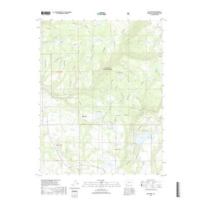
2019 Map of Millwood
USGS Topo · Published 2019About this map
San Juan National Forest defines the northern reaches of this landscape, where a sophisticated network of water management features highlights the region's agricultural and industrial heritage. The small settlement of Millwood is surrounded by numerous small-scale water projects, including the Old Logging Camp Reservoir, Lumber Company Reservoir, and Apple Tree Reservoir. These names, alongside the complex system of the Joe Moore Ditch and Turkey Cr Ditch, point to a history of timber extraction and coordinated irrigation in this part of Montezuma County. To the southeast, the larger Jackson Gulch Reservoir and its Jackson Gulch Inlet Canal represent more substantial engineering efforts. For those tracing historical land use, the presence of Mines A and features like the Sellers and McClane Reservoir offer specific points of interest for identifying property boundaries and early 21st-century infrastructure.
Find a feature on this map
97 named features on this map. Tap any name to fly to it.
Don’t see what you’re looking for? This feature index may not catch every label — zoom into the map to look around manually.
Map Details
Editions of this 2019 Millwood Map
This is the sole edition of this map. No revisions or reprints were ever made.
Other maps of this area

1895 · La Plata
USGS Topo · 1:62,500

1897 · La Plata
USGS Topo · 1:62,500

1897 · Rico
USGS Topo · 1:62,500

1898 · Rico
USGS Topo · 1:62,500

1899 · La Plata
USGS Topo · 1:62,500

1899 · Rico
USGS Topo · 1:62,500

1908 · La Plata
USGS Topo · 1:62,500

1956 · Cortez
USGS Topo · 1:250,000

1958 · Cortez
USGS Topo · 1:250,000

1959 · Cortez
USGS Topo · 1:250,000