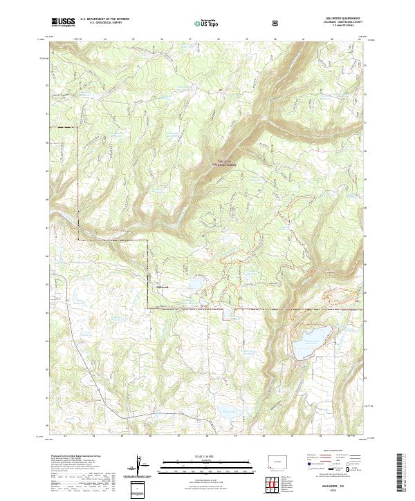
2022 Map of Millwood
USGS Topo · Published 2022About this map
Millwood is situated at the heart of this mountain landscape, surrounded by an intricate system of water management within the San Juan National Forest. The map documents a dense network of water infrastructure, including the Jackson Gulch Reservoir, Adams Reservoir, and Iron Spring Reservoir, alongside various canals like the Jackson Gulch Inlet Canal and Turkey Creek Ditch. This reliance on water storage suggests the importance of irrigation and resource management for the surrounding area.
Find a feature on this map
91 named features on this map. Tap any name to fly to it.
Don’t see what you’re looking for? This feature index may not catch every label — zoom into the map to look around manually.
Map Details
Editions of this 2022 Millwood Map
This is the sole edition of this map. No revisions or reprints were ever made.
Other maps of this area

1895 · La Plata
USGS Topo · 1:62,500

1897 · La Plata
USGS Topo · 1:62,500

1897 · Rico
USGS Topo · 1:62,500

1898 · Rico
USGS Topo · 1:62,500

1899 · La Plata
USGS Topo · 1:62,500

1899 · Rico
USGS Topo · 1:62,500

1908 · La Plata
USGS Topo · 1:62,500

1956 · Cortez
USGS Topo · 1:250,000

1958 · Cortez
USGS Topo · 1:250,000

1959 · Cortez
USGS Topo · 1:250,000