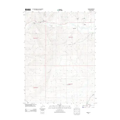
2013 Map of Milner
USGS Topo · Published 2013About this map
The Yampa River winds through the northern reaches of this Routt County landscape, anchoring the settlement at Milner and the nearby siding of McGregor. This 2013 topographic survey captures the industrial and natural character of the region, where energy extraction at the Tow Creek Oil Field contrasts with the high-elevation basin of Twentymile Park. The terrain is deeply incised by numerous drainages and gulches, including Coal View Gulch, Butcherknife Gulch, and Mc Crosky Gulch, reflecting the complex geology that has long supported local mining and ranching interests.
Find a feature on this map
33 named features on this map. Tap any name to fly to it.
Don’t see what you’re looking for? This feature index may not catch every label — zoom into the map to look around manually.
Map Details
Editions of this 2013 Milner Map
This is the sole edition of this map. No revisions or reprints were ever made.
Other maps of this area

1911 · Hahns Peak
USGS Topo · 1:125,000

1913 · Hahns Peak
USGS Topo · 1:125,000

1923 · Pilot Knob
USGS Topo · 1:62,500

1924 · Mt. Harris
USGS Topo · 1:48,000

1925 · Pilot Knob
USGS Topo · 1:62,500

1926 · Mount Harris
USGS Topo · 1:62,500

1954 · Craig
USGS Topo · 1:250,000

1957 · Craig
USGS Topo · 1:250,000

1958 · Craig
USGS Topo · 1:250,000

1960 · Craig
USGS Topo · 1:250,000