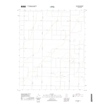
2019 Map of Milo Center
USGS Topo · Published 2019About this map
Tierra Blanca Rd and Grenada Rd anchor a geometric grid of county roads across this High Plains landscape in Deaf Smith County. The terrain is defined by subtle depressions and ephemeral water catchments typical of the Llano Estacado, which dictate the placement of transportation routes like Fm 1057 and Ranch 1057. This 2019 survey documents a highly organized agricultural layout where section lines are strictly followed by routes such as Co Rd 10 and Co Rd 17. The map illustrates the persistence of the rectangular survey system in modern Texas ranching and farming, with distinctive north-south arteries like Co Rd HH and Co Rd GG providing access to the expansive interior acreage of the Milo Center area.
Find a feature on this map
22 named features on this map. Tap any name to fly to it.
Don’t see what you’re looking for? This feature index may not catch every label — zoom into the map to look around manually.
Map Details
Editions of this 2019 Milo Center Map
This is the sole edition of this map. No revisions or reprints were ever made.
Other maps of this area

1954 · Tucumcari
USGS Topo · 1:250,000

1954 · Clovis
USGS Topo · 1:250,000

1958 · Clovis
USGS Topo · 1:250,000

1958 · Tucumcari
USGS Topo · 1:250,000

1965 · Allison Ranch
USGS Topo · 1:24,000

1966 · Overstreet Lake
USGS Topo · 1:24,000

1966 · Ford
USGS Topo · 1:24,000

1970 · Hereford
USGS Topo · 1:24,000

1971 · Westway
USGS Topo · 1:24,000

1971 · Hereford NE
USGS Topo · 1:24,000