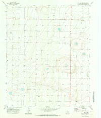
1971 Map of Milo Center
USGS Topo · Published 1973About this map
Milo Center stands as the primary settlement hub in this high plains landscape of Deaf Smith County, situated at a key rural intersection. The 1971 planetable survey reveals an agricultural economy heavily dependent on groundwater, evidenced by a dense network of numbered wells distributed across the gridded terrain. These features, such as Well 4029, Well 3958, and Well 3894, illustrate the systematic development of the Panhandle's irrigation infrastructure during the early 1970s.
Find a feature on this map
32 named features on this map. Tap any name to fly to it.
Don’t see what you’re looking for? This feature index may not catch every label — zoom into the map to look around manually.
Map Details
Editions of this 1971 Milo Center Map
This is the sole edition of this map. No revisions or reprints were ever made.
Other maps of this area

1954 · Tucumcari
USGS Topo · 1:250,000

1954 · Clovis
USGS Topo · 1:250,000

1958 · Clovis
USGS Topo · 1:250,000

1958 · Tucumcari
USGS Topo · 1:250,000

1965 · Allison Ranch
USGS Topo · 1:24,000

1966 · Overstreet Lake
USGS Topo · 1:24,000

1966 · Ford
USGS Topo · 1:24,000

1970 · Hereford
USGS Topo · 1:24,000

1971 · Westway
USGS Topo · 1:24,000

1971 · Hereford NE
USGS Topo · 1:24,000