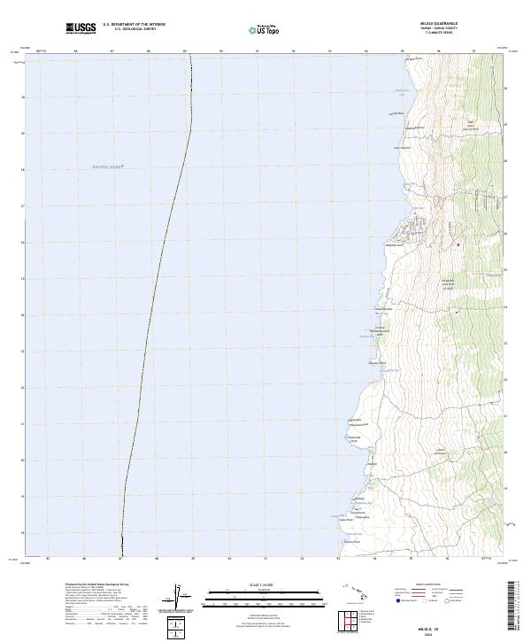
2024 Map of Milolii
USGS Topo · Published 2024About this map
Recent lava flows define the coastal landscape of South Kona, where the 'Ālika Lava Flow of 1919 and the Ho'ōpūloa Lava Flow of 1926 reach the Pacific Ocean. This 2024 survey documents a rugged shoreline of basalt and sheltered coves, including Miloli'i Bay and Honomalino Bay. The modern street grid around Milolii Rd is reflected in a series of numbered avenues, such as Kai Ave and Waena Ave, showing the local development patterns nestled between historic volcanic events. Topographic details highlight unique coastal landmarks like Arched Rock and the Laeloa Mokuokaha'ilani Rock, providing a clear view of how the Island of Hawai'i continues to be shaped by its geological history. Numerous named points and bays, from Pa'akai Point in the north to Niu'ō'ū Point in the south, serve as critical reference points for local navigation and coastal history.
Find a feature on this map
49 named features on this map. Tap any name to fly to it.
Don’t see what you’re looking for? This feature index may not catch every label — zoom into the map to look around manually.
Map Details
Editions of this 2024 Milolii Map
This is the sole edition of this map. No revisions or reprints were ever made.
Other maps of this area

1928 · Hoopuloa
USGS Topo · 1:62,500

1954 · Hawaii South
USGS Topo · 1:250,000

1959 · Hawaii South
USGS Topo · 1:250,000

1961 · Hawaii South
USGS Topo · 1:250,000

1962 · Hawaii South
USGS Topo · 1:250,000

1962 · Milolii
USGS Topo · 1:24,000
1962 · Manuka Bay
USGS Topo · 1:24,000

1962 · Pohue Bay
USGS Topo · 1:24,000

1962 · Papa
USGS Topo · 1:24,000
1962 · Kauluoa Point
USGS Topo · 1:24,000