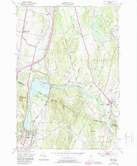
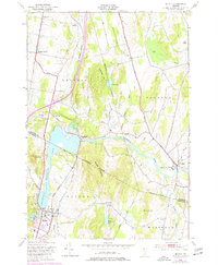
1948 Map of Milton
USGS Topo · Published 1987About this map
The Lamoille River defines the mid-century landscape of this northern Vermont region, cutting between the slopes of Georgia Mountain and Prospect Hill. As the post-war era brought modernization, the expansion of Interchange 18 and road revisions reflect the shift toward regional connectivity, though the traditional backbone of the Central Vermont railroad remains prominent. The map details the transition from rural school districts to larger institutions, noting both School No 14 and the Bellows Free Academy in Fairfax. Local genealogy is well-supported by the inclusion of small burial grounds like Hope Cem and Beaver Cem, alongside longstanding settlements such as Georgia Center and East Georgia. The topography is marked by significant water features, from the broad Arrowhead Mountain Lake to the secluded Milton Pond and Silver Lake, illustrating the varied terrain that shaped the development of Milton and its surrounding townships.
Find a feature on this map
38 named features on this map. Tap any name to fly to it.
Don’t see what you’re looking for? This feature index may not catch every label — zoom into the map to look around manually.
Map Details
Editions of this 1948 Milton Map
5 editions found
Other maps of this area

1913 · Milton
USGS Topo · 1:48,000

1914 · St. Albans
USGS Topo · 1:48,000

1915 · Milton
USGS Topo · 1:62,500

1916 · St. Albans
USGS Topo · 1:62,500

1920 · Franklin Pond
USGS Topo · 1:62,500

1922 · Enosburg Falls
USGS Topo · 1:48,000

1924 · Enosburg Falls
USGS Topo · 1:62,500

1925 · Mount Mansfield
USGS Topo · 1:48,000

1927 · Mount Mansfield
USGS Topo · 1:62,500

1943 · St. Albans
USGS Topo · 1:62,500