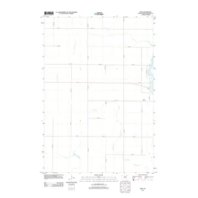
2012 Map of Mina
USGS Topo · Published 2012About this map
Mina anchors the eastern edge of this Edmunds County landscape, where the prairie grid meets the shores of Lake Parmley. This early 21st-century survey illustrates the organized layout of the Great Plains, defined by an exacting network of section roads like 134th St and 370th Ave. The natural hydrology of the region is dominated by Stony Run, which meanders across the southern sections, providing a stark contrast to the rigid geometry of the agricultural parcels. While the settlement at Mina is small, its street plan is clearly delineated, with Main St serving as a focal point near the lake. The interplay between the managed water levels of Lake Parmley and the surrounding farmland reveals a rural economy deeply integrated with its local water resources and transport grid.
Find a feature on this map
19 named features on this map. Tap any name to fly to it.
Don’t see what you’re looking for? This feature index may not catch every label — zoom into the map to look around manually.
Map Details
Editions of this 2012 Mina Map
This is the sole edition of this map. No revisions or reprints were ever made.
Other maps of this area

1899 · Ellendale
USGS Topo · 1:125,000

1899 · Northville
USGS Topo · 1:125,000

1954 · Aberdeen
USGS Topo · 1:250,000

1956 · Aberdeen
USGS Topo · 1:250,000

1970 · Lake Parmley
USGS Topo · 1:24,000

1970 · Mina SW
USGS Topo · 1:24,000
1970 · Lake Parmley SW
USGS Topo · 1:24,000

1970 · Wetonka South
USGS Topo · 1:24,000

1970 · Mina NW
USGS Topo · 1:24,000
1970 · Richmond SW
USGS Topo · 1:24,000