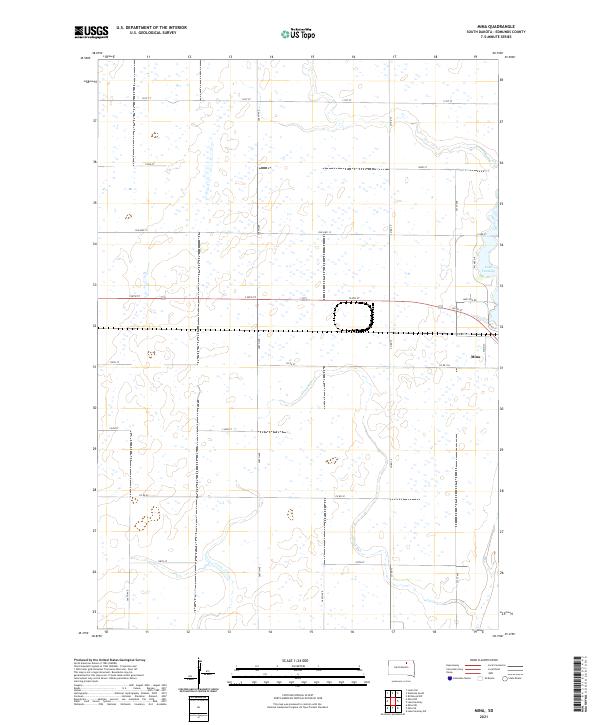
2021 Map of Mina
USGS Topo · Published 2021About this map
Mina anchors the eastern edge of this Edmunds County survey, situated just south of the recreational and hydrological waters of Lake Parmley. The landscape is defined by the rigid grid of the Public Land Survey System, with township lines for t123n r67w and t123n r66w meeting at the center. Waterways like Stony Run cut diagonally across the section lines, reflecting the natural drainage patterns of the Dakota prairie. Transportation routes are dominated by a series of numbered section roads, though the path of Old Hwy 12 provides a trace of earlier transcontinental travel before more modern alignments. The proximity of Lake Side Rd and W Lake Dr to the lake suggests a localized cluster of residential or seasonal development distinct from the broader agricultural surrounding.
Find a feature on this map
27 named features on this map. Tap any name to fly to it.
Don’t see what you’re looking for? This feature index may not catch every label — zoom into the map to look around manually.
Map Details
Editions of this 2021 Mina Map
This is the sole edition of this map. No revisions or reprints were ever made.
Other maps of this area

1899 · Ellendale
USGS Topo · 1:125,000

1899 · Northville
USGS Topo · 1:125,000

1954 · Aberdeen
USGS Topo · 1:250,000

1956 · Aberdeen
USGS Topo · 1:250,000

1970 · Lake Parmley
USGS Topo · 1:24,000

1970 · Mina SW
USGS Topo · 1:24,000
1970 · Lake Parmley SW
USGS Topo · 1:24,000

1970 · Wetonka South
USGS Topo · 1:24,000

1970 · Mina NW
USGS Topo · 1:24,000
1970 · Richmond SW
USGS Topo · 1:24,000