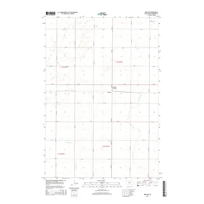
2015 Map of Mina NW
USGS Topo · Published 2015About this map
Craven and the nearby Craven Corner anchor this section of Edmunds County, showing the agricultural character of the South Dakota landscape in the early 21st century. The map depicts a highly organized grid of rural roads, including 134th St and 363rd Ave, which partition the prairie into large sections for farming and ranching. Waterways such as Preachers Run and the N Fork Snake Cr wind through the terrain, indicating the natural drainage patterns that have shaped land use in the region for generations. In the northeastern corner, the Strassburg Cem serves as a small but significant landmark for those researching local family histories and early settlement patterns in this part of the state.
Find a feature on this map
24 named features on this map. Tap any name to fly to it.
Don’t see what you’re looking for? This feature index may not catch every label — zoom into the map to look around manually.
Map Details
Editions of this 2015 Mina NW Map
This is the sole edition of this map. No revisions or reprints were ever made.
Other maps of this area

1899 · Ellendale
USGS Topo · 1:125,000

1899 · Northville
USGS Topo · 1:125,000

1954 · Aberdeen
USGS Topo · 1:250,000

1956 · Aberdeen
USGS Topo · 1:250,000

1970 · Mina SW
USGS Topo · 1:24,000

1970 · Wetonka South
USGS Topo · 1:24,000

1970 · Mina NW
USGS Topo · 1:24,000
1970 · Mina
USGS Topo · 1:24,000

1970 · Leola SW
USGS Topo · 1:24,000
1970 · Mina SE
USGS Topo · 1:24,000