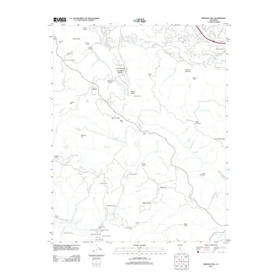
2012 Map of Mindego Hill
USGS Topo · Published 2012About this map
Foothill College and the surrounding residential enclaves of Los Trancos Woods and Vista Verde anchor this area in the hills above the Santa Clara Valley. The landscape transitions from suburban educational and residential clusters into a high-elevation backcountry defined by major ridges, including Russian Ridge and Monte Bello Ridge. A network of specialized agricultural and recreational sites is scattered throughout these summits, including the Big Dipper Ranch, Pony Tracks Ranch, and Skyline Ranch.
Find a feature on this map
114 named features on this map. Tap any name to fly to it.
Don’t see what you’re looking for? This feature index may not catch every label — zoom into the map to look around manually.
Map Details
Editions of this 2012 Mindego Hill Map
This is the sole edition of this map. No revisions or reprints were ever made.
Other maps of this area

1897 · Palo Alto
USGS Topo · 1:62,500

1899 · Palo Alto
USGS Topo · 1:62,500

1902 · Santa Cruz
USGS Topo · 1:125,000

1940 · Halfmoon Bay
USGS Topo · 1:62,500

1940 · Ano Nuevo
USGS Topo · 1:62,500

1941 · Ano Nuevo Pt.
USGS Topo · 1:62,500

1941 · Palo Alto
USGS Topo · 1:62,500

1942 · Ano Nuevo
USGS Topo · 1:62,500

1943 · Palo Alto
USGS Topo · 1:62,500

1943 · Halfmoon Bay
USGS Topo · 1:62,500