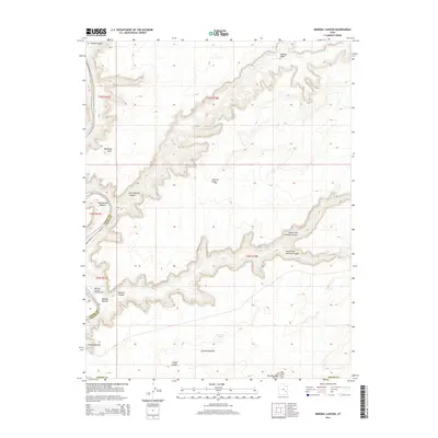
2014 Map of Mineral Canyon
USGS Topo · Published 2014About this map
Green River meanders along the western edge of this Grand County landscape, where the high desert plateau is deeply incised by a complex system of drainage basins. The area is defined by sharp topographic contrasts between the upland flats and the river level, with access points like Mineral Bottom and Cottonwood Bottom providing rare level ground at the water's edge. The ruggedness of the terrain is evident in the names of landmarks such as Hell Roaring Canyon and Deadman Point, reflecting the challenging geography of the high desert.
Find a feature on this map
23 named features on this map. Tap any name to fly to it.
Don’t see what you’re looking for? This feature index may not catch every label — zoom into the map to look around manually.
Map Details
Editions of this 2014 Mineral Canyon Map
This is the sole edition of this map. No revisions or reprints were ever made.
Other maps of this area

1885 · San Rafael
USGS Topo · 1:250,000

1885 · La Sal
USGS Topo · 1:250,000

1951 · The Knoll
USGS Topo · 1:62,500

1951 · Upheaval Dome
USGS Topo · 1:62,500

1952 · Tidwell 4 SE
USGS Topo · 1:24,000

1952 · Moab 3 NE
USGS Topo · 1:24,000

1952 · Carlisle 2 NW
USGS Topo · 1:24,000

1952 · Moab 3 SE
USGS Topo · 1:24,000

1952 · Carlisle 2 NE
USGS Topo · 1:24,000

1952 · Tidwell 4 NE
USGS Topo · 1:24,000