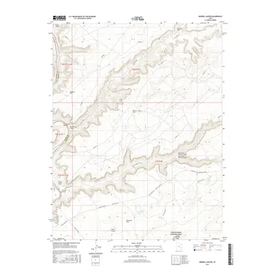
2017 Map of Mineral Canyon
USGS Topo · Published 2017About this map
Canyonlands National Park dominates the southern reaches of this landscape, where the high desert plateau breaks into a complex system of drainages. The Green River carves along the western edge, creating riverside features like Cottonwood Bottom and providing a stark contrast to the arid heights above. This 2017 survey reveals the intricate network of primitive access routes essential for navigation in this remote corner of Grand County, including the famous White Rim Trail and the steep descent of Mineral Canyon Rd.
Find a feature on this map
29 named features on this map. Tap any name to fly to it.
Don’t see what you’re looking for? This feature index may not catch every label — zoom into the map to look around manually.
Map Details
Editions of this 2017 Mineral Canyon Map
This is the sole edition of this map. No revisions or reprints were ever made.
Other maps of this area

1885 · San Rafael
USGS Topo · 1:250,000

1885 · La Sal
USGS Topo · 1:250,000

1951 · The Knoll
USGS Topo · 1:62,500

1951 · Upheaval Dome
USGS Topo · 1:62,500

1952 · Tidwell 4 SE
USGS Topo · 1:24,000

1952 · Moab 3 NE
USGS Topo · 1:24,000

1952 · Carlisle 2 NW
USGS Topo · 1:24,000

1952 · Moab 3 SE
USGS Topo · 1:24,000

1952 · Carlisle 2 NE
USGS Topo · 1:24,000

1952 · Tidwell 4 NE
USGS Topo · 1:24,000