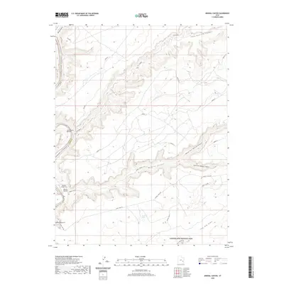
2020 Map of Mineral Canyon
USGS Topo · Published 2020About this map
The Green River carves a deep path through Labyrinth Canyon on this modern survey, where the river's slow oxbows define the western edge of the quadrangle. Significant alluvial deposits such as Cottonwood Bottom, Mineral Bottom, and Tidwell Bottom provide the rare flat ground necessary for human activity in this vertical landscape. The presence of the Mineral Canyon Strip near the riverbank indicates the modern reliance on aviation to access these isolated reaches, while historical overland routes are represented by the winding Horse Thief Trl and the Mineral Canyon Rd.
Find a feature on this map
20 named features on this map. Tap any name to fly to it.
Don’t see what you’re looking for? This feature index may not catch every label — zoom into the map to look around manually.
Map Details
Editions of this 2020 Mineral Canyon Map
This is the sole edition of this map. No revisions or reprints were ever made.
Other maps of this area

1885 · San Rafael
USGS Topo · 1:250,000

1885 · La Sal
USGS Topo · 1:250,000

1951 · The Knoll
USGS Topo · 1:62,500

1951 · Upheaval Dome
USGS Topo · 1:62,500

1952 · Tidwell 4 SE
USGS Topo · 1:24,000

1952 · Moab 3 NE
USGS Topo · 1:24,000

1952 · Carlisle 2 NW
USGS Topo · 1:24,000

1952 · Moab 3 SE
USGS Topo · 1:24,000

1952 · Carlisle 2 NE
USGS Topo · 1:24,000

1952 · Tidwell 4 NE
USGS Topo · 1:24,000