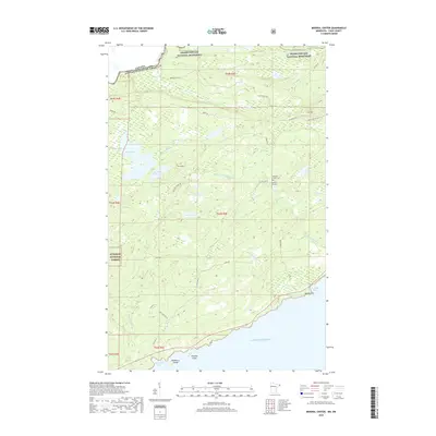
2019 Map of Mineral Center
USGS Topo · Published 2019About this map
Mineral Center sits within a complex geography of protected lands and international borders in this 2019 survey. The settlement is anchored by the Mineral Center Cem, located near the junction of Old Hwy 61 and Co Rd 17. To the north, the terrain transitions into the Grand Portage National Monument, where the historic Grand Portage Trl follows the rugged corridor near the Pigeon River, which defines the boundary between the Canada United States of America.
Find a feature on this map
38 named features on this map. Tap any name to fly to it.
Don’t see what you’re looking for? This feature index may not catch every label — zoom into the map to look around manually.
Map Details
Editions of this 2019 Mineral Center Map
This is the sole edition of this map. No revisions or reprints were ever made.
Other maps of this area

1958 · Hancock
USGS Topo · 1:250,000

1959 · Mineral Center
USGS Topo · 1:24,000

1959 · Fort William
USGS Topo · 1:250,000
1959 · Grand Portage
USGS Topo · 1:24,000

1960 · Hancock
USGS Topo · 1:250,000
1960 · The Cascades
USGS Topo · 1:24,000
1960 · Farquhar Peak
USGS Topo · 1:24,000
1960 · South Fowl Lake
USGS Topo · 1:24,000
1960 · Hovland
USGS Topo · 1:24,000

1961 · Hancock
USGS Topo · 1:250,000