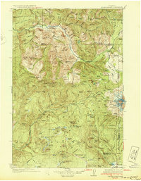
1956 Map of Mineral
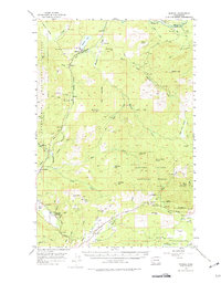
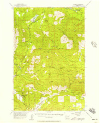
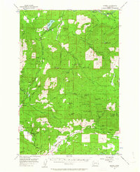
USGS Topo · Published 1975About this map
Mineral lies at the heart of this landscape, situated alongside the expansive Mineral Lake where the timber and rail economy of the mid-1950s converged. The Chicago Milwaukee St Paul and Pacific railroad tracks wind through the valley, connecting small settlements like Carlson and Glenoma to the broader regional network. To the south, the industrial character of the era is evident in the presence of the Fern Gap Railroad and scattered Gravel Pits, while the Fern Gap Guard Sta stands watch over the surrounding timberlands.
Find a feature on this map
54 named features on this map. Tap any name to fly to it.
Don’t see what you’re looking for? This feature index may not catch every label — zoom into the map to look around manually.
Map Details
Editions of this 1956 Mineral Map
3 editions found
Other maps of this area

1919 · Mount St Helens
USGS Topo · 1:125,000

1924 · Mt Rainier
USGS Topo · 1:96,000

1926 · Steamboat Mtn
USGS Topo · 1:125,000

1928 · Mt Rainier
USGS Topo · 1:125,000
1931 · Steamboat Mtn
USGS Topo · 1:125,000

1937 · Eatonville
USGS Topo · 1:125,000

1941 · Tanwax Lake
USGS Topo · 1:62,500

1944 · Ohop Valley
USGS Topo · 1:62,500

1949 · Ohop Valley
USGS Topo · 1:62,500

1950 · Yakima
USGS Topo · 1:250,000