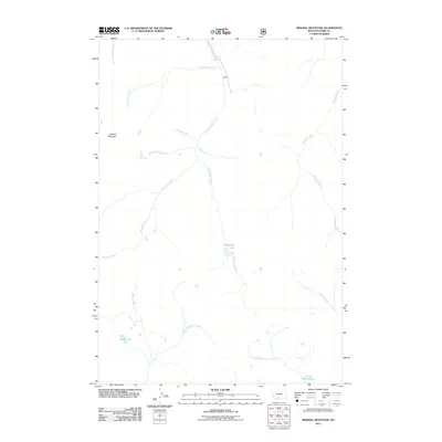
2011 Map of Mineral Mountain
USGS Topo · Published 2011About this map
Mineral Mountain towers over a high-altitude landscape defined by a complex network of alpine drainage systems in this 2011 U.S. Forest Service data-supported survey. The hydrology of the region is centered on the West Fork Mill Creek and Passage Creek, which carve deep paths through the terrain. High-elevation water bodies like Thompson Lake, Castle Lake, and the uniquely named Charlie White Lake suggest a glaciated geography where snowmelt feeds numerous tributaries, including Monitor Creek and Coffee Pot Creek. This map captures a preserved wilderness area where the lack of developed infrastructure emphasizes the natural hydrological patterns of the northern Rockies. The absence of roads or settlements across the quadrangle highlights its status as a remote backcountry environment, making it a critical reference for understanding the pristine drainage basins of Park County, Montana.
Find a feature on this map
17 named features on this map. Tap any name to fly to it.
Don’t see what you’re looking for? This feature index may not catch every label — zoom into the map to look around manually.
Map Details
Editions of this 2011 Mineral Mountain Map
This is the sole edition of this map. No revisions or reprints were ever made.
Other maps of this area

1891 · Livingston
USGS Topo · 1:250,000

1893 · Livingston
USGS Topo · 1:250,000

1940 · Mt. Cowen
USGS Topo · 1:62,500

1940 · Mt Wallace
USGS Topo · 1:62,500

1943 · Mt Wallace
USGS Topo · 1:62,500

1943 · Mt Cowen
USGS Topo · 1:62,500

1947 · Bozeman
USGS Topo · 1:250,000

1948 · Bozeman
USGS Topo · 1:250,000

1955 · Bozeman
USGS Topo · 1:250,000

1955 · Emigrant
USGS Topo · 1:62,500