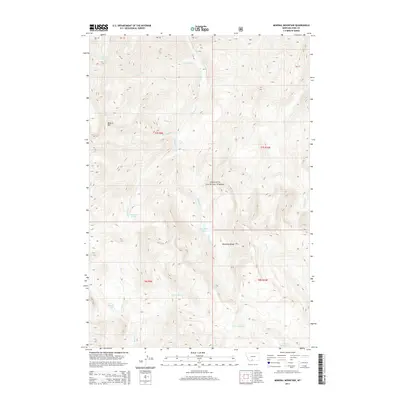
2014 Map of Mineral Mountain
USGS Topo · Published 2014About this map
Mineral Mtn and the surrounding peaks of the Absaroka Range dominate this high-elevation landscape within the Gallatin National Forest. The 2014 survey reveals an intricate drainage network characterized by steep headwaters, including the W Fork Mill Cr and Passage Cr. High mountain basins hold scattered water bodies such as Arrastra Lake, Thompson Lake, and the aptly named Lonesome Pond. The lack of road infrastructure and human settlements on this sheet highlights the wilderness character of southern Park County, where the topography is defined purely by its hydrological features like Coffee Pot Cr and Gorge Cr. Local history and land use are represented through the inclusion of township and range lines, such as t7s r9e, which provide a formal grid over the mountain peaks and the remote Castle Lake.
Find a feature on this map
26 named features on this map. Tap any name to fly to it.
Don’t see what you’re looking for? This feature index may not catch every label — zoom into the map to look around manually.
Map Details
Editions of this 2014 Mineral Mountain Map
This is the sole edition of this map. No revisions or reprints were ever made.
Other maps of this area

1891 · Livingston
USGS Topo · 1:250,000

1893 · Livingston
USGS Topo · 1:250,000

1940 · Mt. Cowen
USGS Topo · 1:62,500

1940 · Mt Wallace
USGS Topo · 1:62,500

1943 · Mt Wallace
USGS Topo · 1:62,500

1943 · Mt Cowen
USGS Topo · 1:62,500

1947 · Bozeman
USGS Topo · 1:250,000

1948 · Bozeman
USGS Topo · 1:250,000

1955 · Bozeman
USGS Topo · 1:250,000

1955 · Emigrant
USGS Topo · 1:62,500