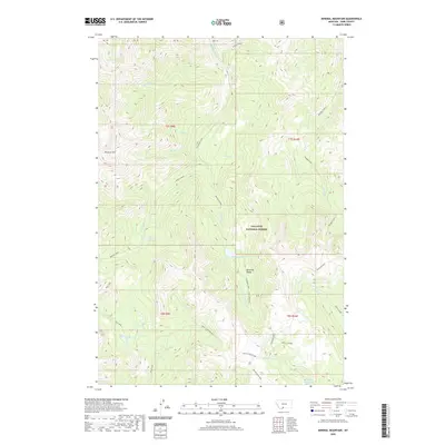
2020 Map of Mineral Mountain
USGS Topo · Published 2020About this map
Gallatin National Forest encompasses this high-altitude landscape in Park County, where the peaks of the Absaroka Range dominate the horizon. The terrain is defined by extreme relief, stretching from the heights of Mineral Mtn and Mount Wallace down to a complex drainage system. Water patterns here are dictated by the steep topography, with snowmelt and springs feeding numerous alpine basins such as Arrastra Lake, Castle Lake, and Charlie White Lake. The map reveals a wild geography of named ridges and divides, notably Wicked Ridge in the north and Horse Creek Divide to the south. This area serves as a critical headwaters region, where the W Fork Mill Cr and Passage Creek begin their descent. Aside from Ash Mountain Way, the land remains largely free of developed infrastructure, preserving the natural drainage patterns of Monitor Cr and Bear Cr.
Find a feature on this map
33 named features on this map. Tap any name to fly to it.
Don’t see what you’re looking for? This feature index may not catch every label — zoom into the map to look around manually.
Map Details
Editions of this 2020 Mineral Mountain Map
This is the sole edition of this map. No revisions or reprints were ever made.
Other maps of this area

1891 · Livingston
USGS Topo · 1:250,000

1893 · Livingston
USGS Topo · 1:250,000

1940 · Mt. Cowen
USGS Topo · 1:62,500

1940 · Mt Wallace
USGS Topo · 1:62,500

1943 · Mt Wallace
USGS Topo · 1:62,500

1943 · Mt Cowen
USGS Topo · 1:62,500

1947 · Bozeman
USGS Topo · 1:250,000

1948 · Bozeman
USGS Topo · 1:250,000

1955 · Bozeman
USGS Topo · 1:250,000

1955 · Emigrant
USGS Topo · 1:62,500