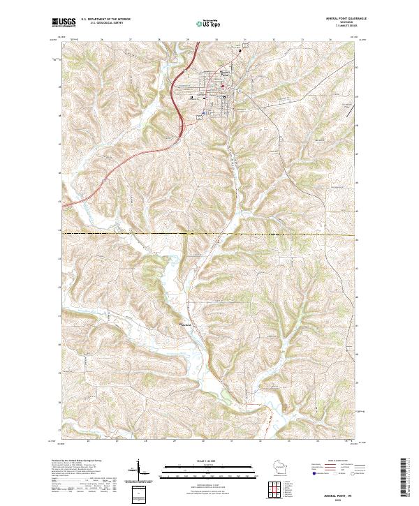
2022 Map of Mineral Point
USGS Topo · Published 2022About this map
Mineral Point serves as the central hub of this survey, where a dense street grid meets the winding courses of Mineral Point Br and its larger Mineral Point Branch. The town's deep roots are visible through its concentration of burial grounds, including the Old Mineral Point Cem, Graceland Cem, and Saint Mary's Cem. These landmarks, along with streets like Shakebag St and Merry Christmas Ln, reflect the local character of Iowa County. To the south, the settlement of Slateford sits near the banks of the Pecatonica River, which meanders across the border into Lafayette County. The landscape is defined by the drainage systems of Rock Br and Cottage Inn Br, carving through the topography between family-named sites such as Jim Benson Field.
Find a feature on this map
78 named features on this map. Tap any name to fly to it.
Don’t see what you’re looking for? This feature index may not catch every label — zoom into the map to look around manually.
Map Details
Editions of this 2022 Mineral Point Map
This is the sole edition of this map. No revisions or reprints were ever made.
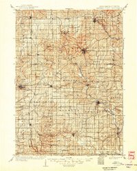
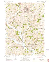
Historical Maps of Mineral Point Through Time
3 maps found