
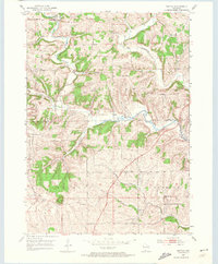
1952 Map of Mifflin
USGS Topo · Published 1954About this map
Mifflin sits at the northern edge of this Wisconsin survey, where the East Pecatonica River winds through a landscape marked by early industry and civic history. The presence of a Mine Dump and several Quarry sites near the river indicates the region's mineral extraction history, while a dense network of country schools like Peniel Sch and Lincoln Sch highlights the distribution of rural families during the early 1950s. To the south, the terrain rises significantly toward Belmont Mound, a prominent landmark adjacent to the First Capitol State Park. This park commemorates the site of Wisconsin’s first territorial government, located near the small settlement of Leslie. The map also captures the local spiritual geography through numerous rural congregations and their burial grounds, including Bryn Zion Ch and the Powell Cem, which served the farming communities in the townships of Mifflin, Linden, and Belmont.
Find a feature on this map
31 named features on this map. Tap any name to fly to it.
Don’t see what you’re looking for? This feature index may not catch every label — zoom into the map to look around manually.
Map Details
Editions of this 1952 Mifflin Map
2 editions found
Other maps of this area

1902 · Mineral Point
USGS Topo · 1:125,000

1952 · Platteville
USGS Topo · 1:24,000

1952 · Calamine
USGS Topo · 1:24,000

1952 · Rewey
USGS Topo · 1:24,000

1952 · Montfort
USGS Topo · 1:24,000

1952 · Mineral Point
USGS Topo · 1:24,000

1952 · Dodgeville
USGS Topo · 1:24,000

1952 · Belmont
USGS Topo · 1:24,000

1952 · Linden
USGS Topo · 1:24,000

1959 · Dubuque
USGS Topo · 1:250,000