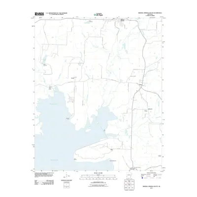
2011 Map of Mineral Springs South
USGS Topo · Published 2011About this map
Millwood Lake dominates the southwestern portion of this landscape, its waters reaching into the surrounding terrain via the Saline River and numerous smaller tributaries. This 2011 survey captures the rural character of Howard County, where small settlements like Tollette, Schaal, and Allbrook are connected by a network of local roads such as Bright Star Rd and Funderburg Rd. The importance of the lake's shoreline is evident through named access points like Cottonshed Landing and Saline Landing.
Find a feature on this map
56 named features on this map. Tap any name to fly to it.
Don’t see what you’re looking for? This feature index may not catch every label — zoom into the map to look around manually.
Map Details
Editions of this 2011 Mineral Springs South Map
This is the sole edition of this map. No revisions or reprints were ever made.
Other maps of this area

1950 · Ashdown East
USGS Topo · 1:24,000

1950 · Red Bluff
USGS Topo · 1:24,000

1950 · Ben Lomond
USGS Topo · 1:24,000

1951 · Ben Lomond
USGS Topo · 1:24,000

1951 · Red Bluff
USGS Topo · 1:24,000

1951 · Ashdown East
USGS Topo · 1:24,000

1951 · Mineral Springs South
USGS Topo · 1:24,000

1951 · Columbus
USGS Topo · 1:24,000

1951 · Mineral Springs North
USGS Topo · 1:24,000

1951 · Nashville
USGS Topo · 1:24,000