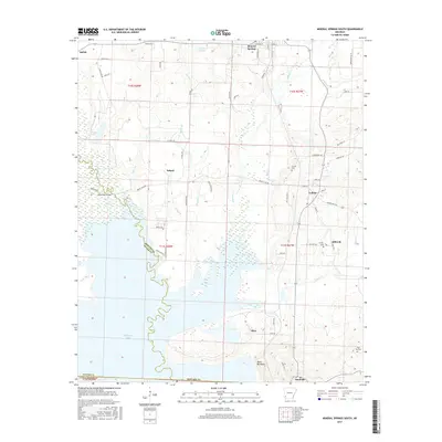
2017 Map of Mineral Springs South
USGS Topo · Published 2017About this map
Millwood Lake dominates the southern reaches of this landscape, its complex shoreline defining the boundary where Howard and Sevier Counties meet. This 2017 survey details a region of diverse water systems, from the course of the Saline River to smaller drainages like Brushy Cr and Plum Cr. The settlement pattern reflects established rural communities such as Mineral Springs, Tollette, and Saratoga, interspersed with several small cemeteries that offer significant value for genealogical research, including Shiloh Cem and the High Hill Cem in the southeast. A notable topographic feature, the Devils Backbone, rises near the community of Okay, providing a distinct contrast to the wetland areas and lake margins. The map also captures the network of local transit, including State Hwy 332 and various named routes like Bright Star Rd, which connect the scattered hamlets and historic sites across this Howard County terrain.
Find a feature on this map
73 named features on this map. Tap any name to fly to it.
Don’t see what you’re looking for? This feature index may not catch every label — zoom into the map to look around manually.
Map Details
Editions of this 2017 Mineral Springs South Map
This is the sole edition of this map. No revisions or reprints were ever made.
Other maps of this area

1950 · Ashdown East
USGS Topo · 1:24,000

1950 · Red Bluff
USGS Topo · 1:24,000

1950 · Ben Lomond
USGS Topo · 1:24,000

1951 · Ben Lomond
USGS Topo · 1:24,000

1951 · Red Bluff
USGS Topo · 1:24,000

1951 · Ashdown East
USGS Topo · 1:24,000

1951 · Mineral Springs South
USGS Topo · 1:24,000

1951 · Columbus
USGS Topo · 1:24,000

1951 · Mineral Springs North
USGS Topo · 1:24,000

1951 · Nashville
USGS Topo · 1:24,000