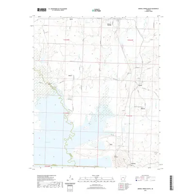
2020 Map of Mineral Springs South
USGS Topo · Published 2020About this map
Millwood Lake dominates the southwestern corner of this survey, where the waters of the Saline River meet the Little River County line. The landscape is defined by the transition from upland settlements like Mineral Springs and Tollette down to the alluvial basins and wetlands of the river system. Historically significant cemeteries, including Crofton Cemetery and Shirley Cemetery, are situated near old crossroads and small communities such as Allbrook and Schaal.
Find a feature on this map
71 named features on this map. Tap any name to fly to it.
Don’t see what you’re looking for? This feature index may not catch every label — zoom into the map to look around manually.
Map Details
Editions of this 2020 Mineral Springs South Map
This is the sole edition of this map. No revisions or reprints were ever made.
Other maps of this area

1950 · Ashdown East
USGS Topo · 1:24,000

1950 · Red Bluff
USGS Topo · 1:24,000

1950 · Ben Lomond
USGS Topo · 1:24,000

1951 · Ben Lomond
USGS Topo · 1:24,000

1951 · Red Bluff
USGS Topo · 1:24,000

1951 · Ashdown East
USGS Topo · 1:24,000

1951 · Mineral Springs South
USGS Topo · 1:24,000

1951 · Columbus
USGS Topo · 1:24,000

1951 · Mineral Springs North
USGS Topo · 1:24,000

1951 · Nashville
USGS Topo · 1:24,000