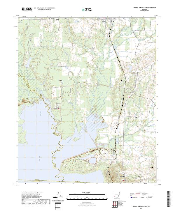
2024 Map of Mineral Springs South
USGS Topo · Published 2024About this map
The Saline River defines the western edge of this South Arkansas landscape, where bottomlands meet the rising elevation of Devils Backbone near Saratoga. The area is characterized by a network of small creeks including Plum Creek, Mine Creek, and Dillard Creek, which feed into the river system. Small communities such as Tollette and Mineral Springs serve as local hubs, connected by a grid of named roads like Bright Star Rd and Funderburg Rd. Local genealogy is well-documented through several burial grounds, including Shiloh Cem in the north and High Hill Cem in the southeast. The central portion of the map near Okay shows an intricate pattern of wetlands and braided streams, reflecting the transition from upland timber to riverine lowlands. To the north, Kever Lake sits near the settlement of Shiloh, providing a record of the region's diverse water features and rural settlement patterns.
Find a feature on this map
74 named features on this map. Tap any name to fly to it.
Don’t see what you’re looking for? This feature index may not catch every label — zoom into the map to look around manually.
Map Details
Editions of this 2024 Mineral Springs South Map
This is the sole edition of this map. No revisions or reprints were ever made.
Other maps of this area

1950 · Ashdown East
USGS Topo · 1:24,000

1950 · Red Bluff
USGS Topo · 1:24,000

1950 · Ben Lomond
USGS Topo · 1:24,000

1951 · Ben Lomond
USGS Topo · 1:24,000

1951 · Red Bluff
USGS Topo · 1:24,000

1951 · Ashdown East
USGS Topo · 1:24,000

1951 · Mineral Springs South
USGS Topo · 1:24,000

1951 · Columbus
USGS Topo · 1:24,000

1951 · Mineral Springs North
USGS Topo · 1:24,000

1951 · Nashville
USGS Topo · 1:24,000