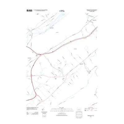
2013 Map of Mingoville
USGS Topo · Published 2013About this map
Nittany Valley and the surrounding ridges of Centre County define this 2013 landscape, where small crossroads communities like Zion and Mingoville are connected by the Nittany Valley Dr corridor. To the north, the terrain transitions toward Foster Joseph Sayers Lake and the winding course of Bald Eagle Cr. The map shows a distinct pattern of valley floor agriculture and settlement, with communities such as Mount Eagle, Forest, and Lyonstown positioned near the base of prominent landforms like Sand Ridge and Lambs Gap. In the northeast, the village of Jacksonville sits near Howard Gap, marking an important passage through the ridge system. This modern survey details the complex network of local roads, such as Curtain Village Rd near Curtin and the residential layout of the smaller valley pockets, reflecting the contemporary rural and suburban character of this central Pennsylvania region.
Find a feature on this map
92 named features on this map. Tap any name to fly to it.
Don’t see what you’re looking for? This feature index may not catch every label — zoom into the map to look around manually.
Map Details
Editions of this 2013 Mingoville Map
This is the sole edition of this map. No revisions or reprints were ever made.
Other maps of this area

1908 · Bellefonte
USGS Topo · 1:62,500

1909 · Bellefonte
USGS Topo · 1:62,500

1921 · Howard
USGS Topo · 1:48,000

1923 · Howard
USGS Topo · 1:62,500

1924 · Centre Hall
USGS Topo · 1:62,500

1928 · Snow Shoe
USGS Topo · 1:48,000

1929 · Centre Hall
USGS Topo · 1:62,500

1931 · Show Shoe
USGS Topo · 1:62,500

1943 · Lewistown
USGS Topo · 1:125,000

1950 · Harrisburg
USGS Topo · 1:250,000