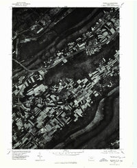
1977 Map of Mingoville
USGS Topo · Published 1979About this map
Mingoville and its surrounding agricultural landscape are captured in high detail in this orthophotomap, which utilizes aerial imagery rather than traditional topographic sketching. The settlement is positioned within the distinct corridor of the Bald Eagle Valley, bounded by the prominent relief of Nittany Mountain. The imagery highlights the late-1970s land use patterns, showing a complex patchwork of cultivated fields and woodlots that follow the natural contours of the valley floor. Bald Eagle Creek provides the primary drainage for the region, winding through the valley north of the mountain range. This specific 1977 aerial perspective, produced in cooperation with the Soil Conservation Service, offers an unfiltered look at the intersection of rural development and the physical geography of Centre County.
Find a feature on this map
4 named features on this map. Tap any name to fly to it.
Don’t see what you’re looking for? This feature index may not catch every label — zoom into the map to look around manually.
Map Details
Editions of this 1977 Mingoville Map
This is the sole edition of this map. No revisions or reprints were ever made.
Other maps of this area

1908 · Bellefonte
USGS Topo · 1:62,500

1909 · Bellefonte
USGS Topo · 1:62,500

1921 · Howard
USGS Topo · 1:48,000

1923 · Howard
USGS Topo · 1:62,500

1924 · Centre Hall
USGS Topo · 1:62,500

1928 · Snow Shoe
USGS Topo · 1:48,000

1929 · Centre Hall
USGS Topo · 1:62,500

1931 · Show Shoe
USGS Topo · 1:62,500

1943 · Lewistown
USGS Topo · 1:125,000

1950 · Harrisburg
USGS Topo · 1:250,000