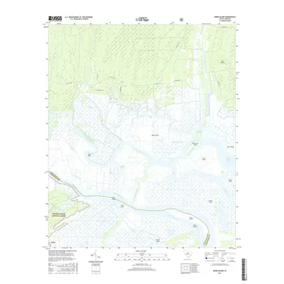
2017 Map of Minim Island
USGS Topo · Published 2017About this map
The North Santee River and South Santee River diverge to create a complex network of marshlands and estuarine islands along the South Carolina coast. This 2017 survey details the Lowcountry landscape where the Intracoastal Waterway cuts through historical channels like the Estherville Minim Creek Canal. The southern portion of the map includes a section of the Francis Marion National Forest and the Washo Reserve, protecting a significant ecological buffer against the Atlantic. Large landmasses such as Minim Island and Murphy Island are defined by a maze of tidal creeks, including Kinloch Creek and Alligator Creek. Traces of earlier navigation and land use appear in the form of Old Kinloch Rd and Fourmile Creek Canal, showing how human engineering has historically interfaced with this shifting river delta environment.
Find a feature on this map
46 named features on this map. Tap any name to fly to it.
Don’t see what you’re looking for? This feature index may not catch every label — zoom into the map to look around manually.
Map Details
Editions of this 2017 Minim Island Map
This is the sole edition of this map. No revisions or reprints were ever made.
Other maps of this area

1942 · Cape Romain
USGS Topo · 1:24,000

1942 · Mc Clellanville
USGS Topo · 1:24,000

1942 · Santee Point
USGS Topo · 1:24,000

1942 · North Island
USGS Topo · 1:24,000

1943 · Kilsock Bay
USGS Topo · 1:24,000

1943 · Santee
USGS Topo · 1:24,000

1943 · Minim Island
USGS Topo · 1:24,000

1943 · Georgetown South
USGS Topo · 1:24,000

1947 · Georgetown South
USGS Topo · 1:24,000

1949 · Georgetown
USGS Topo · 1:250,000