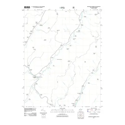
2011 Map of Minnehaha Springs
USGS Topo · Published 2011About this map
Minnehaha Springs serves as the central hub of this Pocahontas County landscape, where the Minnehaha Springs Post Office stands near the confluence of Knapp Creek and Douthat Creek. The terrain is defined by a dense network of hollows and ridges, many bearing family names that offer significant value for genealogical research, such as McLaughlin Hollow and Sampson Pike Hollow. Local infrastructure is represented by the Dourif Airport and the Seneca Lake Dam on Guy Run. Small family burial grounds, including the Shinaberry Cemetery and McLaughlin Cemetery, are tucked away on elevated ground like Miller Ridge. The southeastern portion of the map is dominated by the flow of Little Back Creek, which winds past Ryder Gap and through Ryder Hollow, illustrating the typical ridge-and-valley drainage patterns of the West Virginia highlands.
Find a feature on this map
80 named features on this map. Tap any name to fly to it.
Don’t see what you’re looking for? This feature index may not catch every label — zoom into the map to look around manually.
Map Details
Editions of this 2011 Minnehaha Springs Map
This is the sole edition of this map. No revisions or reprints were ever made.
Other maps of this area

1891 · Huntersville
USGS Topo · 1:125,000

1894 · Huntersville
USGS Topo · 1:125,000

1901 · Monterey
USGS Topo · 1:125,000

1922 · Cass
USGS Topo · 1:48,000

1923 · Marlinton
USGS Topo · 1:48,000

1923 · Warm Springs
USGS Topo · 1:48,000

1923 · Mingo
USGS Topo · 1:48,000

1924 · Cass
USGS Topo · 1:62,500

1925 · Mingo
USGS Topo · 1:62,500

1925 · Marlinton
USGS Topo · 1:62,500