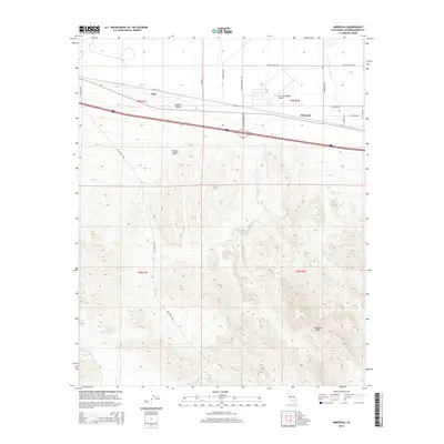
2015 Map of Minneola
USGS Topo · Published 2015About this map
Minneola and Gale sit at the transition between the wide Mojave Valley and the rising elevations of the Mojave Desert interior. This high-desert landscape is defined by the critical infrastructure of the mid-20th century, including the Barstow-Daggett Airport and a network of arterial roads like Silver Valley Rd and Santa Fe St. These routes follow the traditional paths of travel that once supported local mining and desert homesteading.
Find a feature on this map
22 named features on this map. Tap any name to fly to it.
Don’t see what you’re looking for? This feature index may not catch every label — zoom into the map to look around manually.
Map Details
Editions of this 2015 Minneola Map
This is the sole edition of this map. No revisions or reprints were ever made.
Other maps of this area

1953 · San Bernardino
USGS Topo · 1:250,000

1953 · Yermo
USGS Topo · 1:24,000
1953 · Nebo
USGS Topo · 1:24,000

1955 · Newberry
USGS Topo · 1:62,500

1955 · Ord Mountains
USGS Topo · 1:62,500

1955 · Rodman Mountains
USGS Topo · 1:62,500

1956 · San Bernardino
USGS Topo · 1:250,000

1956 · Daggett
USGS Topo · 1:62,500

1957 · San Bernardino
USGS Topo · 1:250,000

1958 · San Bernardino
USGS Topo · 1:250,000