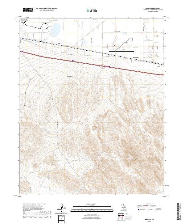
2021 Map of Minneola
USGS Topo · Published 2021About this map
The Mojave Valley dominates the northern landscape of this San Bernardino County survey, where the settlements of Gale and Minneola sit along a busy transportation corridor. This area reflects a mid-twentieth century transition where older desert routes like the National Trails Hwy and Santa Fe St parallel modern interstate infrastructure. The Barstow-Daggett Airport stands as a prominent landmark on the valley floor, south of Silver Valley Rd.
Find a feature on this map
31 named features on this map. Tap any name to fly to it.
Don’t see what you’re looking for? This feature index may not catch every label — zoom into the map to look around manually.
Map Details
Editions of this 2021 Minneola Map
This is the sole edition of this map. No revisions or reprints were ever made.
Other maps of this area

1953 · San Bernardino
USGS Topo · 1:250,000

1953 · Yermo
USGS Topo · 1:24,000
1953 · Nebo
USGS Topo · 1:24,000

1955 · Newberry
USGS Topo · 1:62,500

1955 · Ord Mountains
USGS Topo · 1:62,500

1955 · Rodman Mountains
USGS Topo · 1:62,500

1956 · San Bernardino
USGS Topo · 1:250,000

1956 · Daggett
USGS Topo · 1:62,500

1957 · San Bernardino
USGS Topo · 1:250,000

1958 · San Bernardino
USGS Topo · 1:250,000