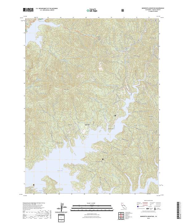
2023 Map of Minnesota Mountain
USGS Topo · Published 2023About this map
Shasta Lake dominates the southern reaches of this landscape, its fingers reaching into the canyons of the Shasta National Forest. The map centers on the high-elevation terrain of Minnesota Mtn and the historical site of Bully Hill, an area defined by deep gulches and steep ridgelines that drop toward the Pit River. The hydrology of the region is intricately detailed, showing how Dekkas Creek and Winnibulli Creek drain the northern slopes. Notable landmarks like Killanger Peak and Monday Flat provide clear geographic points of reference for those studying the complex topography between the lake and the high peaks of Brock Mtn and Chirpchatter Mtn. Local family and place-named features, such as Hoover Gulch and Frenchman Gulch, offer a window into the historical naming conventions of this Shasta County wilderness.
Find a feature on this map
51 named features on this map. Tap any name to fly to it.
Don’t see what you’re looking for? This feature index may not catch every label — zoom into the map to look around manually.
Map Details
Editions of this 2023 Minnesota Mountain Map
This is the sole edition of this map. No revisions or reprints were ever made.
Other maps of this area

1890 · Red Bluff
USGS Topo · 1:250,000

1894 · Red Bluff
USGS Topo · 1:250,000

1901 · Redding
USGS Topo · 1:125,000

1944 · Redding
USGS Topo · 1:62,500

1946 · Lamoine
USGS Topo · 1:62,500

1946 · Redding
USGS Topo · 1:62,500

1949 · Bollibokka Mtn
USGS Topo · 1:62,500

1953 · Millville
USGS Topo · 1:62,500
1957 · Project City
USGS Topo · 1:24,000
1957 · Lamoine
USGS Topo · 1:62,500