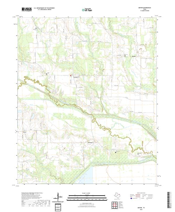
2022 Map of Minter
USGS Topo · Published 2022About this map
The North Sulphur River and South Sulphur River define the agricultural landscape along the Lamar and Delta county line. This contemporary survey reveals a pattern of rural settlement clustered around small communities like Minter, Taylortown, and Kensing, which are connected by an intricate network of county roads. The landscape is heavily influenced by the drainage patterns of numerous creeks, including Pickering Cr, Big Sandy Cr, and Little Sandy Cr, which feed the river basins.
Find a feature on this map
55 named features on this map. Tap any name to fly to it.
Don’t see what you’re looking for? This feature index may not catch every label — zoom into the map to look around manually.
Map Details
Editions of this 2022 Minter Map
This is the sole edition of this map. No revisions or reprints were ever made.
Other maps of this area

1903 · Paris
USGS Topo · 1:125,000

1948 · Paris
USGS Topo · 1:62,500

1949 · Paris
USGS Topo · 1:62,500

1953 · Texarkana
USGS Topo · 1:250,000

1956 · Texarkana
USGS Topo · 1:250,000

1962 · Sulphur Bluff
USGS Topo · 1:24,000

1963 · Mitchell Creek
USGS Topo · 1:24,000

1963 · Minter
USGS Topo · 1:24,000

1963 · Cunningham
USGS Topo · 1:24,000

1964 · Deport
USGS Topo · 1:24,000