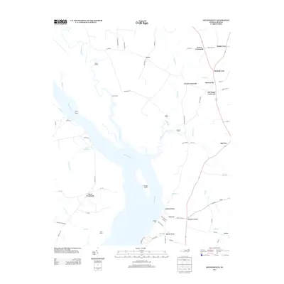
2013 Map of Mintonsville
USGS Topo · Published 2013About this map
The Chowan River defines this part of Gates County, where a network of landings and ferries once served as primary transit points for the local agricultural economy. Features like Cannon Ferry, Woodleys Wharf, and Hurdle Landing illustrate the historic reliance on water-based commerce before modern road networks dominated the landscape. Large water bodies such as Taylor Millpond and tributaries like Bennetts Cr weave through the interior, shaping the placement of early settlements.
Find a feature on this map
68 named features on this map. Tap any name to fly to it.
Don’t see what you’re looking for? This feature index may not catch every label — zoom into the map to look around manually.
Map Details
Editions of this 2013 Mintonsville Map
This is the sole edition of this map. No revisions or reprints were ever made.
Other maps of this area

1904 · Edenton
USGS Topo · 1:62,500

1906 · Beckford
USGS Topo · 1:48,000

1907 · Beckford
USGS Topo · 1:62,500

1908 · Winton
USGS Topo · 1:62,500

1940 · Beckford
USGS Topo · 1:62,500

1942 · Edenton
USGS Topo · 1:62,500

1943 · Edenton
USGS Topo · 1:62,500

1953 · Norfolk
USGS Topo · 1:250,000
1981 · Merchants Millpond
USGS Topo · 1:24,000
1981 · Gatesville
USGS Topo · 1:24,000