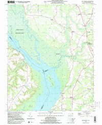
1997 Map of Mintonsville
USGS Topo · Published 2000About this map
The Chowan River dominates this corner of northeastern North Carolina, serving as the primary geographical divider between Gates and Hertford counties. This landscape is characterized by its intricate wetland systems, particularly the Chowan Swamp State Game Lands, where Bennetts Creek, Catherine Creek, and Warwick Creek converge into the river's wide channel. The map reveals a rural settlement pattern defined by numerous crossroads communities and small hamlets, such as Mintonsville, Walton Crossroads, and Hutson Corner, which developed around the region's agricultural and river-based transport hubs.
Find a feature on this map
40 named features on this map. Tap any name to fly to it.
Don’t see what you’re looking for? This feature index may not catch every label — zoom into the map to look around manually.
Map Details
Editions of this 1997 Mintonsville Map
This is the sole edition of this map. No revisions or reprints were ever made.
Other maps of this area

1904 · Edenton
USGS Topo · 1:62,500

1906 · Beckford
USGS Topo · 1:48,000

1907 · Beckford
USGS Topo · 1:62,500

1908 · Winton
USGS Topo · 1:62,500

1940 · Beckford
USGS Topo · 1:62,500

1942 · Edenton
USGS Topo · 1:62,500

1943 · Edenton
USGS Topo · 1:62,500

1953 · Norfolk
USGS Topo · 1:250,000
1981 · Merchants Millpond
USGS Topo · 1:24,000
1981 · Gatesville
USGS Topo · 1:24,000