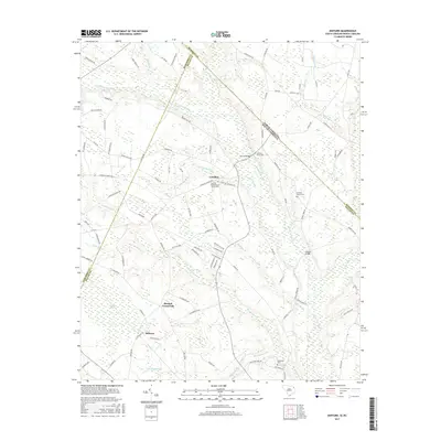
2017 Map of Minturn
USGS Topo · Published 2017About this map
The Little Pee Dee River and the extensive Sweat Swamp system define the low-lying geography of this borderland where South Carolina meets North Carolina. Small agricultural settlements like Carolina and Minturn are centers of community life, anchored by spiritual landmarks such as the Carolina Presbyterian Church and the adjacent Carolina Cemetery. Further south, Sinclair Crossroads marks a junction of rural routes near the Marlboro and Dillon county line.
Find a feature on this map
98 named features on this map. Tap any name to fly to it.
Don’t see what you’re looking for? This feature index may not catch every label — zoom into the map to look around manually.
Map Details
Editions of this 2017 Minturn Map
This is the sole edition of this map. No revisions or reprints were ever made.
Other maps of this area

1942 · Rockingham
USGS Topo · 1:125,000

1943 · Gum Swamp
USGS Topo · 1:62,500

1953 · Florence
USGS Topo · 1:250,000

1954 · Florence
USGS Topo · 1:250,000

1960 · Dillon East
USGS Topo · 1:24,000

1960 · Dillon West
USGS Topo · 1:24,000

1971 · Minturn
USGS Topo · 1:24,000

1971 · Johns
USGS Topo · 1:24,000

1972 · Clio
USGS Topo · 1:24,000
1972 · Mc Coll
USGS Topo · 1:24,000