
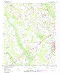
1960 Map of Dillon West
USGS Topo · Published 1961About this map
Dillon serves as a focal point of this 1960s study, showing the city's western expansion near the Atlantic Coast Line and Seaboard Air Line railroads. The landscape is defined by the winding course of the Little Pee Dee River and the broad, low-lying Betsy Jackson Bay, interspersed with several small communities such as Little Rock and Centerville. Local life is anchored by numerous rural congregations and burial grounds, including Reedy Creek Ch, Dothan Ch, and Ramsey Cem. The presence of several Storage Bins and a Drive-in Theater reflects the mid-century intersection of agriculture and emerging automobile culture. Small agricultural settlements like McCormick Crossroads and Manning Crossroads illustrate the period's dispersed residential patterns across the South Carolina coastal plain.
Find a feature on this map
39 named features on this map. Tap any name to fly to it.
Don’t see what you’re looking for? This feature index may not catch every label — zoom into the map to look around manually.
Map Details
Editions of this 1960 Dillon West Map
2 editions found
Other maps of this area

1942 · Rockingham
USGS Topo · 1:125,000

1943 · Gum Swamp
USGS Topo · 1:62,500

1953 · Florence
USGS Topo · 1:250,000

1954 · Florence
USGS Topo · 1:250,000

1959 · Fork
USGS Topo · 1:24,000

1960 · Latta
USGS Topo · 1:24,000

1960 · Dillon East
USGS Topo · 1:24,000

1971 · Minturn
USGS Topo · 1:24,000

1972 · Clio
USGS Topo · 1:24,000
1972 · Oak Grove
USGS Topo · 1:24,000