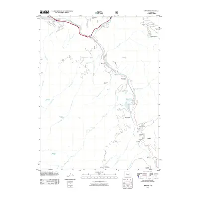
2011 Map of Minturn
USGS Topo · Published 2011About this map
Minturn serves as the central hub for this high-altitude corridor along the Eagle River, where mountain recreation and industrial history meet. To the south, the map documents a dense concentration of mining operations including the Eagle Mine, Red Cliff District Mine, and Ben Butler Mine near the settlements of Gilman and Belden. These sites, connected by features like the Newhouse Tunnel, trace the region's legacy of zinc and silver extraction. The landscape transitions from the residential streets of Maloit Park to the expansive slopes of the Vail Ski Area and Game Creek Bowl in the northeast. Water management for the area is evident through the Nottingham and Puder Ditch and the Bolts Lake Dam. Higher elevations reveal a network of trails and spiritual markers like the Tigwon Community House, providing a detailed look at the social and economic geography of the Eagle River Valley.
Find a feature on this map
66 named features on this map. Tap any name to fly to it.
Don’t see what you’re looking for? This feature index may not catch every label — zoom into the map to look around manually.
Map Details
Editions of this 2011 Minturn Map
This is the sole edition of this map. No revisions or reprints were ever made.
Other maps of this area

1889 · Leadville
USGS Topo · 1:125,000

1891 · Leadville
USGS Topo · 1:125,000

1909 · Mount Jackson
USGS Topo · 1:125,000

1911 · Mount Jackson
USGS Topo · 1:125,000

1934 · Minturn
USGS Topo · 1:62,500

1942 · Leadville
USGS Topo · 1:125,000

1949 · Holy Cross
USGS Topo · 1:62,500

1950 · Minturn
USGS Topo · 1:62,500

1951 · Holy Cross
USGS Topo · 1:62,500

1957 · Leadville
USGS Topo · 1:250,000